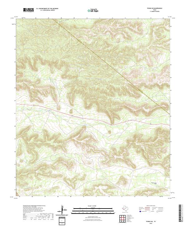
2022 Map of Tesnus NE
USGS Topo · Published 2022About this map
The rugged topography of the Trans-Pecos region is captured along the administrative divide of the Pecos Co Brewster Co line. This landscape is defined by its drainage patterns, notably the prominent descent of Downie Draw in the north and the arid course of Javelina Draw further south. The terrain transitions from dense, complex contouring in the highland sections to the broad, level expanse of Rattlesnake Flats in the southeast corner. Intermittent waterways like Dry Cr illustrate the ephemeral nature of the local hydrology, where seasonal runoff carves deep into the limestone and desert soil. While largely unpopulated, the map documents the essential physical geography of this West Texas borderland, highlighting the natural landmarks and boundaries that have oriented ranchers and surveyors for generations.
Find a feature on this map
5 named features on this map. Tap any name to fly to it.
Don’t see what you’re looking for? This feature index may not catch every label — zoom into the map to look around manually.
Map Details
Editions of this 2022 Tesnus NE Map
This is the sole edition of this map. No revisions or reprints were ever made.
Other maps of this area

1920 · Longfellow
USGS Topo · 1:125,000

1954 · Fort Stockton
USGS Topo · 1:250,000

1958 · Fort Stockton
USGS Topo · 1:250,000

1968 · Housetop Mountains
USGS Topo · 1:24,000

1968 · Tesnus
USGS Topo · 1:24,000

1968 · Cap Rock Butte
USGS Topo · 1:24,000

1968 · F C Ranch
USGS Topo · 1:24,000

1968 · Fresno Creek
USGS Topo · 1:24,000

1968 · Longfellow
USGS Topo · 1:24,000
1968 · Tesnus SE
USGS Topo · 1:24,000