
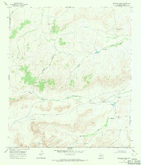
1968 Map of F C Ranch
USGS Topo · Published 1971About this map
The F C Ranch serves as a focal point for this arid West Texas landscape, where life revolves around water management and aviation in a region of significant elevation changes. Situated within the Wildcat Mountains, the terrain is defined by a series of deep drainage systems including Big Canyon, Downie Draw, and Pyle Draw. The map reveals a specialized cattle ranching infrastructure from the late 1960s, evidenced by a network of earthen tanks and wells such as Chicken Tank, Steer Tank, and the Old Ranch Windmill. A remote Landing Strip and Radio Tower highlight the distances involved in managing such an expansive territory. The isolation of the Pecos County rangeland is further marked by the absence of major towns, focusing instead on landmarks like Lewis Well and the industrial activity at a Gravel Pit near Jimmy Tank.
Find a feature on this map
27 named features on this map. Tap any name to fly to it.
Don’t see what you’re looking for? This feature index may not catch every label — zoom into the map to look around manually.
Map Details
Editions of this 1968 F C Ranch Map
This is the sole edition of this map. No revisions or reprints were ever made.
Other maps of this area

1920 · Longfellow
USGS Topo · 1:125,000

1954 · Fort Stockton
USGS Topo · 1:250,000

1958 · Fort Stockton
USGS Topo · 1:250,000

1968 · Cap Rock Butte
USGS Topo · 1:24,000

1968 · Busher Canyon
USGS Topo · 1:24,000

1968 · Toms Canyon
USGS Topo · 1:24,000

1968 · Longfellow
USGS Topo · 1:24,000

1968 · Ebers Camp
USGS Topo · 1:24,000

1968 · Ninemile Ranch
USGS Topo · 1:24,000
1968 · Reininger Draw
USGS Topo · 1:24,000