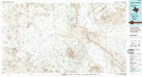
1985 Map of Santiago Mountains
USGS Topo · Published 1994About this map
Santiago Mountains dominate the central spine of this high-desert landscape in the mid-1980s, marking a rugged transition toward the northern reaches of Big Bend National Park. The map documents a sparsely populated ranching and wilderness area where the boundary between Presidio and Brewster counties meets across vast mesa lands like Bandera Mesa and Tascotal Mesa. Human presence is sparse, indicated by isolated landmarks such as House White and several remote landing strips utilized for access to these distant reaches.
Find a feature on this map
38 named features on this map. Tap any name to fly to it.
Don’t see what you’re looking for? This feature index may not catch every label — zoom into the map to look around manually.
Map Details
Editions of this 1985 Santiago Mountains Map
2 editions found
Other maps of this area

1895 · Marfa
USGS Topo · 1:125,000

1895 · Alpine
USGS Topo · 1:125,000

1896 · Polvo
USGS Topo · 1:125,000

1896 · Shafter
USGS Topo · 1:125,000

1903 · Chisos Mountains
USGS Topo · 1:125,000

1903 · Terlingua
USGS Topo · 1:125,000

1904 · Terlingua
USGS Topo · 1:125,000

1905 · Chisos Mountains
USGS Topo · 1:125,000

1917 · Agua Fria
USGS Topo · 1:62,500

1917 · Tascotal Mesa
USGS Topo · 1:62,500