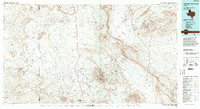
1985 Map of Santiago Mountains
USGS Topo · Published 1994About this map
The Santiago Mountains dominate this 1980s landscape in Brewster County, forming a prominent spine that divides the drainage basins of Terlingua Creek and Maravillas Creek. The area is characterized by isolated outposts like Butcherknife and Cochran, connected by the sparse corridor of Texas 118. To the south, the boundary of Big Bend National Park and the Black Gap State Wildlife Management Area preserve the transition from high mesas like Kokernot Mesa and Nine Point Mesa to the desert floor. The map captures a period of modern ranching and conservation efforts, where landmarks like Santiago Peak and Agua Fria Mountain serve as essential navigational points. In the southeast, the Sierra del Carmen begins its dramatic rise, while intricate drainages like Chalk Draw and Bone Spring Draw reveal the complex hydraulic patterns of the Big Bend region.
Find a feature on this map
65 named features on this map. Tap any name to fly to it.
Don’t see what you’re looking for? This feature index may not catch every label — zoom into the map to look around manually.
Map Details
Editions of this 1985 Santiago Mountains Map
2 editions found
Other maps of this area

1895 · Marfa
USGS Topo · 1:125,000

1895 · Alpine
USGS Topo · 1:125,000

1896 · Polvo
USGS Topo · 1:125,000

1896 · Shafter
USGS Topo · 1:125,000

1903 · Chisos Mountains
USGS Topo · 1:125,000

1903 · Terlingua
USGS Topo · 1:125,000

1904 · Terlingua
USGS Topo · 1:125,000

1905 · Chisos Mountains
USGS Topo · 1:125,000

1917 · Agua Fria
USGS Topo · 1:62,500

1917 · Tascotal Mesa
USGS Topo · 1:62,500