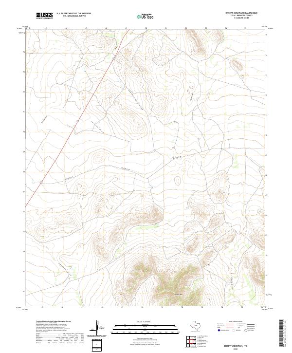
2022 Map of Bissett Mountain
USGS Topo · Published 2022About this map
Bissett Mtn anchors the southern portion of this Brewster County landscape, where the high desert terrain is defined by an extensive network of ephemeral watercourses. This contemporary survey by the U.S. Geological Survey shows a remote ranching region characterized by limited road access, primarily via Benge Ranch Rd and U.S. Highway 67. The map illustrates a drainage pattern typical of the Trans-Pecos, with named features such as Booster Mill Draw, Jackson Draw, and Antelope Draw carving paths through the high-elevation basin. Further south, Emerson Draw and Stroud Draw flank the slopes of the central mountain, providing a clear picture of the land's hydrology and topographical relief in the modern era.
Find a feature on this map
8 named features on this map. Tap any name to fly to it.
Don’t see what you’re looking for? This feature index may not catch every label — zoom into the map to look around manually.
Map Details
Editions of this 2022 Bissett Mountain Map
This is the sole edition of this map. No revisions or reprints were ever made.
Other maps of this area

1894 · Fort Davis
USGS Topo · 1:125,000

1895 · Alpine
USGS Topo · 1:125,000

1897 · Fort Davis
USGS Topo · 1:125,000

1923 · Altuda
USGS Topo · 1:62,500

1929 · Hovey
USGS Topo · 1:125,000

1954 · Fort Stockton
USGS Topo · 1:250,000

1958 · Fort Stockton
USGS Topo · 1:250,000

1972 · Bird Mountain
USGS Topo · 1:24,000

1972 · Elam Mountain
USGS Topo · 1:24,000

1973 · Fort Stockton
USGS Topo · 1:250,000