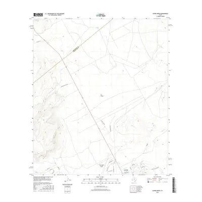
2016 Map of Alpine North
USGS Topo · Published 2016About this map
The high-desert settlement of Alpine occupies the southeastern corner of this study, where the northern limits of town meet the foothills. This West Texas landscape is defined by its drainage systems and expansive ranchlands, with water sources such as Leoncita Springs and Musquiz Cr providing critical points of reference in the arid terrain. The Jeff Davis Co and Brewster Co boundary cuts diagonally across the northern half of the quadrangle, illustrating the vast administrative reach in this part of the state.
Find a feature on this map
27 named features on this map. Tap any name to fly to it.
Don’t see what you’re looking for? This feature index may not catch every label — zoom into the map to look around manually.
Map Details
Editions of this 2016 Alpine North Map
This is the sole edition of this map. No revisions or reprints were ever made.
Other maps of this area

1894 · Fort Davis
USGS Topo · 1:125,000

1895 · Alpine
USGS Topo · 1:125,000

1897 · Fort Davis
USGS Topo · 1:125,000

1954 · Fort Stockton
USGS Topo · 1:250,000

1958 · Fort Stockton
USGS Topo · 1:250,000

1972 · Bird Mountain
USGS Topo · 1:24,000
1972 · Fort Davis SE
USGS Topo · 1:24,000

1972 · Alpine North
USGS Topo · 1:24,000

1972 · Paisano
USGS Topo · 1:24,000

1972 · Mitre Peak
USGS Topo · 1:24,000