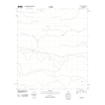
2010 Map of Tesnus NE
USGS Topo · Published 2010About this map
Dry Creek and its various tributaries carve through this arid Pecos County landscape, defining the local hydrology of this West Texas region. The drainage patterns of Downie Draw and Javelina Draw illustrate the subtle elevation shifts typical of the Chihuahuan Desert environment, where water flow is intermittent and largely dependent on seasonal events. In the southern portion of the quadrangle, the terrain levels out into Rattlesnake Flats, a distinct geomorphic feature that characterizes the lower reaches of the local drainage system. This 2010 survey reflects a largely undeveloped area where the primary infrastructure consists of local roads and primitive tracks that follow the natural contours of the desert floor, away from major population centers.
Find a feature on this map
4 named features on this map. Tap any name to fly to it.
Don’t see what you’re looking for? This feature index may not catch every label — zoom into the map to look around manually.
Map Details
Editions of this 2010 Tesnus NE Map
This is the sole edition of this map. No revisions or reprints were ever made.
Other maps of this area

1920 · Longfellow
USGS Topo · 1:125,000

1954 · Fort Stockton
USGS Topo · 1:250,000

1958 · Fort Stockton
USGS Topo · 1:250,000

1968 · Housetop Mountains
USGS Topo · 1:24,000

1968 · Tesnus
USGS Topo · 1:24,000

1968 · Cap Rock Butte
USGS Topo · 1:24,000

1968 · F C Ranch
USGS Topo · 1:24,000

1968 · Fresno Creek
USGS Topo · 1:24,000

1968 · Longfellow
USGS Topo · 1:24,000
1968 · Tesnus SE
USGS Topo · 1:24,000