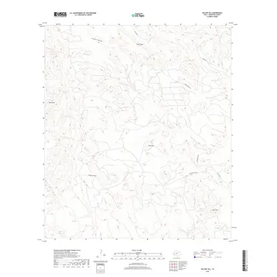
2019 Map of Yellow Hill
USGS Topo · Published 2019About this map
Terlingua Cr winds through the northeastern corner of this Brewster County landscape, a drainage system that anchors a complex network of topographical features. The area is defined by the high elevations of the Blue Range in the west and the prominent Black Ridge to the north, creating a series of deep valleys and natural bottlenecks like the curiously named Lefthand Shutup. Local transportation is facilitated by named primitive routes including Hen Egg Rd and Herman's Peak Rd, which traverse the high desert terrain to connect isolated points of interest such as Yellow Hill. The nomenclature, from Pinks Peak to Saltgrass Draw, reflects a deeply rooted local geography where every rise and wash is individually recognized and named.
Find a feature on this map
11 named features on this map. Tap any name to fly to it.
Don’t see what you’re looking for? This feature index may not catch every label — zoom into the map to look around manually.
Map Details
Editions of this 2019 Yellow Hill Map
This is the sole edition of this map. No revisions or reprints were ever made.
Other maps of this area

1903 · Terlingua
USGS Topo · 1:125,000

1904 · Terlingua
USGS Topo · 1:125,000

1917 · Agua Fria
USGS Topo · 1:62,500

1917 · Tascotal Mesa
USGS Topo · 1:62,500

1931 · Lajitas
USGS Topo · 1:62,500

1937 · Agua Fria
USGS Topo · 1:62,500

1944 · Tascotal Mesa
USGS Topo · 1:62,500

1959 · Emory Peak
USGS Topo · 1:250,000

1965 · Emory Peak
USGS Topo · 1:250,000

1971 · Yellow Hill
USGS Topo · 1:24,000