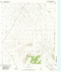
1983 Map of Bissett Mountain
USGS Topo · Published 1984About this map
Bissett Mountain and Carson Mountain anchor this high-desert landscape in Brewster County, where the terrain is defined by an intricate network of seasonal drainage patterns. Surveyed in the mid-1970s and edited for publication in the early 1980s, the map reveals a ranching and transport infrastructure tailored to this arid environment. Strategic water management is evident in the placement of numerous catchments, including Van Pelt Tank, Mah Pe Tank, and Nixon Tank. Natural drainages like Antelope Draw and Booster Mill Draw carve the basin floor between prominent heights like Pate Peak. Human activity is marked by more than just livestock tanks; a remote Landing Strip and a Drill Hole signify the region's connection to wider aviation and exploration interests during this era of West Texas development.
Find a feature on this map
18 named features on this map. Tap any name to fly to it.
Don’t see what you’re looking for? This feature index may not catch every label — zoom into the map to look around manually.
Map Details
Editions of this 1983 Bissett Mountain Map
This is the sole edition of this map. No revisions or reprints were ever made.
Other maps of this area

1894 · Fort Davis
USGS Topo · 1:125,000

1895 · Alpine
USGS Topo · 1:125,000

1897 · Fort Davis
USGS Topo · 1:125,000

1923 · Altuda
USGS Topo · 1:62,500

1929 · Hovey
USGS Topo · 1:125,000

1954 · Fort Stockton
USGS Topo · 1:250,000

1958 · Fort Stockton
USGS Topo · 1:250,000

1972 · Bird Mountain
USGS Topo · 1:24,000

1972 · Elam Mountain
USGS Topo · 1:24,000

1973 · Fort Stockton
USGS Topo · 1:250,000