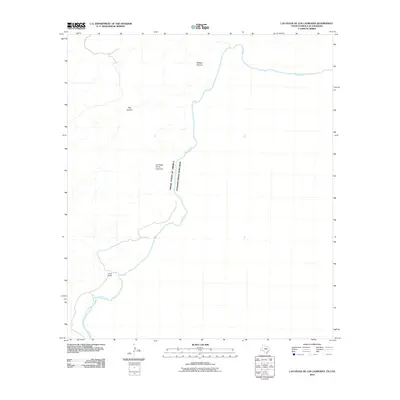
2010 Map of Las Vegas De Los Ladrones
USGS Topo · Published 2010About this map
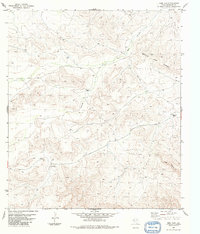
The Rio Grande serves as the central focal point of this 2010 survey, demarcating the international boundary between the United States and Mexico. Located along this winding river corridor, the settlement of Las Vegas de los Ladrones sits within a landscape defined by dramatic drainage systems. The map documents significant terrain features such as Reagan Canyon and Big Canyon, which cut through the arid borderlands and illustrate the complex topography that has historically shaped movement and settlement in this region. Evidence of local land use is visible at Horns Ranch, situated near the riverbanks. This 2010 edition by the U.S. Geological Survey provides a modern topographic perspective on a remote stretch of the border where the natural environment remains the dominant force.
Find a feature on this map
6 named features on this map. Tap any name to fly to it.
Don’t see what you’re looking for? This feature index may not catch every label — zoom into the map to look around manually.
Map Details
Editions of this 2010 Las Vegas De Los Ladrones Map
This is the sole edition of this map. No revisions or reprints were ever made.
Other maps of this area

1918 · Reagan Canyon
USGS Topo · 1:62,500

1918 · Dove Mountain
USGS Topo · 1:62,500

1918 · Bullis Gap
USGS Topo · 1:62,500

1919 · Maravillas Canyon
USGS Topo · 1:62,500

1959 · Emory Peak
USGS Topo · 1:250,000

1965 · Emory Peak
USGS Topo · 1:250,000
1983 · Las Vegas De Los Ladrones SW
USGS Topo · 1:24,000
1983 · Bourland Canyon
USGS Topo · 1:24,000
1983 · Bullis Gap
USGS Topo · 1:24,000
1983 · Beef Gap
USGS Topo · 1:24,000