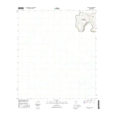
2016 Map of Lajitas OE S
USGS Topo · Published 2016About this map
Big Bend National Park dominates the northeastern corner of this remote borderland survey, where the Rio Grande carves a winding path along the international boundary between Texas and Mexico. The dramatic elevation of the Mesa de Anguila overlooks the river's deep transit through the desert landscape, marking a prominent topographic feature within Brewster Co. This 2016 study captures the intricate drainage patterns of the Chihuahuan Desert, highlighting the stark contrast between the high tablelands and the riparian corridor. The map provides a precise look at the uninhabited terrain where the United States of America and Mexico meet, focusing on the natural contours and hydrography that define this isolated stretch of the frontier.
Find a feature on this map
6 named features on this map. Tap any name to fly to it.
Don’t see what you’re looking for? This feature index may not catch every label — zoom into the map to look around manually.
Map Details
Editions of this 2016 Lajitas OE S Map
This is the sole edition of this map. No revisions or reprints were ever made.
Other maps of this area

1903 · Terlingua
USGS Topo · 1:125,000

1904 · Terlingua
USGS Topo · 1:125,000

1931 · Lajitas
USGS Topo · 1:62,500

1959 · Emory Peak
USGS Topo · 1:250,000

1965 · Emory Peak
USGS Topo · 1:250,000

1971 · Amarilla Mountain
USGS Topo · 1:24,000
1971 · Lajitas
USGS Topo · 1:24,000
1971 · Mesa De Anguila
USGS Topo · 1:24,000
1971 · Santana Mesa
USGS Topo · 1:24,000

1985 · Chisos Mountains
USGS Topo · 1:100,000