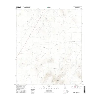
2016 Map of Bissett Mountain
USGS Topo · Published 2016About this map
Bissett Mountain dominates the southeastern quadrant of this Brewster County landscape, providing a high-relief anchor in an area defined by significant topographic variation. The land is marked by seasonal drainage patterns, most notably Antelope Draw and Emerson Draw, which cut through the terrain toward the lower elevations. A rare water source, Burgess Spring, is located at the southern edge of the quadrangle, a critical feature in this arid environment. Human presence is sparse and focused on transportation routes, including Highway 67 slicing through the western portion and Benge Ranch Rd winding through the center. The map reflects a modern management of the high desert, where ranching access roads and traditional water points remain the primary indicators of habitation and land use.
Find a feature on this map
6 named features on this map. Tap any name to fly to it.
Don’t see what you’re looking for? This feature index may not catch every label — zoom into the map to look around manually.
Map Details
Editions of this 2016 Bissett Mountain Map
This is the sole edition of this map. No revisions or reprints were ever made.
Other maps of this area

1894 · Fort Davis
USGS Topo · 1:125,000

1895 · Alpine
USGS Topo · 1:125,000

1897 · Fort Davis
USGS Topo · 1:125,000

1923 · Altuda
USGS Topo · 1:62,500

1929 · Hovey
USGS Topo · 1:125,000

1954 · Fort Stockton
USGS Topo · 1:250,000

1958 · Fort Stockton
USGS Topo · 1:250,000

1972 · Bird Mountain
USGS Topo · 1:24,000

1972 · Elam Mountain
USGS Topo · 1:24,000

1973 · Fort Stockton
USGS Topo · 1:250,000