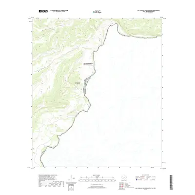
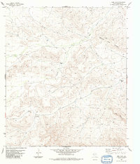
2019 Map of Las Vegas De Los Ladrones
USGS Topo · Published 2019About this map
Rio Grande Wild and Scenic River defines this stretch of the international border, where the Rio Grande carves through the arid landscape of Brewster County. The topography is dominated by deeply incised drainage systems, most notably Reagan Canyon and Big Canyon, which channel toward the river from the high ground. The namesake settlement, Las Vegas de los Ladrones, sits on the northern bank of the river, positioned within a significant bend that highlights the isolation and scale of this borderland environment. This 2019 survey illustrates the dramatic elevation changes and the strict demarcation of the United States of America - Estados Unidos Mexicanos boundary, showing how the physical geography of the river dictates the political line.
Find a feature on this map
6 named features on this map. Tap any name to fly to it.
Don’t see what you’re looking for? This feature index may not catch every label — zoom into the map to look around manually.
Map Details
Editions of this 2019 Las Vegas De Los Ladrones Map
This is the sole edition of this map. No revisions or reprints were ever made.
Other maps of this area

1918 · Reagan Canyon
USGS Topo · 1:62,500

1918 · Dove Mountain
USGS Topo · 1:62,500

1918 · Bullis Gap
USGS Topo · 1:62,500

1919 · Maravillas Canyon
USGS Topo · 1:62,500

1959 · Emory Peak
USGS Topo · 1:250,000

1965 · Emory Peak
USGS Topo · 1:250,000
1983 · Las Vegas De Los Ladrones SW
USGS Topo · 1:24,000
1983 · Bourland Canyon
USGS Topo · 1:24,000
1983 · Bullis Gap
USGS Topo · 1:24,000
1983 · Beef Gap
USGS Topo · 1:24,000