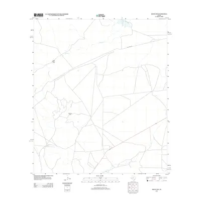
2012 Map of Hovey SW
USGS Topo · Published 2012About this map
Old Alpine Hwy cuts across this high desert landscape, tracing a historical path through the arid terrain of Pecos County. The drainage patterns are defined by the intermittent Musquiz Cr and the Hatch Canyon Draw, which channel seasonal water across the basin. A prominent landmark, Squaws Teat, serves as a traditional navigational point in this open expanse. This 2012 survey illustrates the network of ranch roads and modern transportation corridors that have developed alongside these older landmarks, reflecting the long-term patterns of movement through this region of West Texas.
Find a feature on this map
4 named features on this map. Tap any name to fly to it.
Don’t see what you’re looking for? This feature index may not catch every label — zoom into the map to look around manually.
Map Details
Editions of this 2012 Hovey SW Map
This is the sole edition of this map. No revisions or reprints were ever made.
Other maps of this area

1894 · Fort Davis
USGS Topo · 1:125,000

1895 · Alpine
USGS Topo · 1:125,000

1897 · Fort Davis
USGS Topo · 1:125,000

1923 · Altuda
USGS Topo · 1:62,500

1929 · Hovey
USGS Topo · 1:125,000

1954 · Fort Stockton
USGS Topo · 1:250,000

1958 · Fort Stockton
USGS Topo · 1:250,000

1972 · Elam Mountain
USGS Topo · 1:24,000

1973 · Fort Stockton
USGS Topo · 1:250,000

1980 · Hovey
USGS Topo · 1:24,000