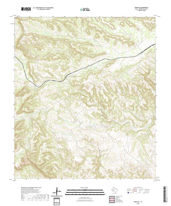
2022 Map of Tesnus SE
USGS Topo · Published 2022About this map
Tesnus serves as a primary reference point in this arid reach of Brewster County, where a complex network of seasonal drainage channels defines the local topography. The landscape is dominated by the winding paths of Cox Creek and Alamo Creek, which gather runoff from several prominent landforms including McRae Canyon and Coffee Pot Canyon. These ephemeral watercourses illustrate the natural erosion patterns characteristic of the Trans-Pecos region, carving deep into the terrain to form features like Oak Draw and the southern reaches of S Alamo Creek. The presence of Pumpjack Creek in the southeast suggests the intersection of the natural landscape with historical resource extraction common to this part of West Texas. This modern survey reflects the enduring isolation of the area, punctuated only by a few named cattle-country landmarks and the small-scale infrastructure required for ranching and transport.
Find a feature on this map
10 named features on this map. Tap any name to fly to it.
Don’t see what you’re looking for? This feature index may not catch every label — zoom into the map to look around manually.
Map Details
Editions of this 2022 Tesnus SE Map
This is the sole edition of this map. No revisions or reprints were ever made.
Other maps of this area

1918 · Dove Mountain
USGS Topo · 1:62,500

1918 · Bullis Gap
USGS Topo · 1:62,500

1920 · Longfellow
USGS Topo · 1:125,000

1954 · Fort Stockton
USGS Topo · 1:250,000

1958 · Fort Stockton
USGS Topo · 1:250,000

1959 · Emory Peak
USGS Topo · 1:250,000

1965 · Emory Peak
USGS Topo · 1:250,000

1968 · Housetop Mountains
USGS Topo · 1:24,000

1968 · Tesnus
USGS Topo · 1:24,000

1968 · Fresno Creek
USGS Topo · 1:24,000