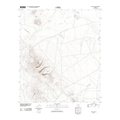
2010 Map of Hovey SW
USGS Topo · Published 2010About this map
Musquiz Creek winds through this arid expanse of Pecos County, where the desert landscape is defined by its drainage patterns and prominent elevations. The terrain is dominated by the ridge of Squaws Teat, a distinctive landmark that overlooks a system of washes including Hatch Canyon Draw and the expansive Antelope Draw. This 2010 survey reflects a largely undeveloped territory in West Texas, marked only by essential rural infrastructure such as U-Bar Tank and the path of Route 67. The distribution of these features reveals the sparse settlement pattern typical of the region, where water sources and topographic markers remain the primary points of orientation for land management and navigation.
Find a feature on this map
6 named features on this map. Tap any name to fly to it.
Don’t see what you’re looking for? This feature index may not catch every label — zoom into the map to look around manually.
Map Details
Editions of this 2010 Hovey SW Map
This is the sole edition of this map. No revisions or reprints were ever made.
Other maps of this area

1894 · Fort Davis
USGS Topo · 1:125,000

1895 · Alpine
USGS Topo · 1:125,000

1897 · Fort Davis
USGS Topo · 1:125,000

1923 · Altuda
USGS Topo · 1:62,500

1929 · Hovey
USGS Topo · 1:125,000

1954 · Fort Stockton
USGS Topo · 1:250,000

1958 · Fort Stockton
USGS Topo · 1:250,000

1972 · Elam Mountain
USGS Topo · 1:24,000

1973 · Fort Stockton
USGS Topo · 1:250,000

1980 · Hovey
USGS Topo · 1:24,000