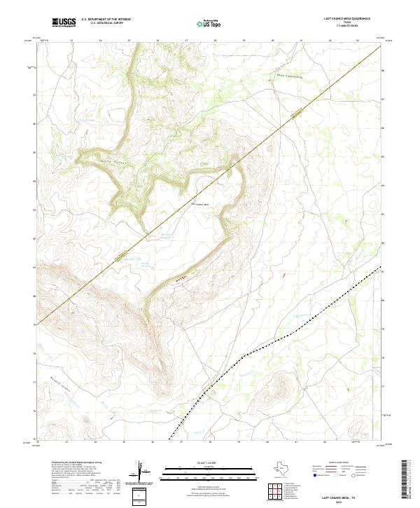
2022 Map of Last Chance Mesa
USGS Topo · Published 2022About this map
Last Chance Mesa dominates this West Texas landscape, straddling the high ground where the Jeff Davis Co Brewster Co line cuts diagonally across the terrain. This area is characterized by dramatic drainage systems and elevated plateaus, with Hatch Canyon and Musquiz Canyon carving significant paths through the earth. Water management in this arid environment is evidenced by a network of named tanks, including Herradura Tank, Big Rock Tank, and Number Ten Tank, which are essential features for local ranching operations. The hydrological network is further defined by seasonal watercourses such as Musquiz Cr, Black Cr, and Hatch Canyon Draw, illustrating how water shapes the settlement patterns and land use in this part of the Trans-Pecos region.
Find a feature on this map
13 named features on this map. Tap any name to fly to it.
Don’t see what you’re looking for? This feature index may not catch every label — zoom into the map to look around manually.
Map Details
Editions of this 2022 Last Chance Mesa Map
This is the sole edition of this map. No revisions or reprints were ever made.
Other maps of this area

1894 · Fort Davis
USGS Topo · 1:125,000

1895 · Alpine
USGS Topo · 1:125,000

1897 · Fort Davis
USGS Topo · 1:125,000

1923 · Altuda
USGS Topo · 1:62,500

1929 · Hovey
USGS Topo · 1:125,000

1954 · Fort Stockton
USGS Topo · 1:250,000

1958 · Fort Stockton
USGS Topo · 1:250,000

1972 · Alpine North
USGS Topo · 1:24,000

1972 · Elam Mountain
USGS Topo · 1:24,000

1973 · Fort Stockton
USGS Topo · 1:250,000