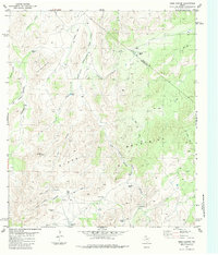
1983 Map of Hess Canyon
USGS Topo · Published 1984About this map
The Glass Mountains dominate this West Texas landscape along the high border of Brewster and Pecos Counties. The terrain is defined by a complex network of canyons and draws, including Javelina Canyon, Dead Horse Canyon, and Gilliland Canyon. This 1983 survey illustrates a high-desert ranching economy dependent on dispersed water sources, marked by numerous named catchments such as Michigan Tank, China Tank, Piñon Tank, and the uniquely named Double Jug Windmill.
Find a feature on this map
30 named features on this map. Tap any name to fly to it.
Don’t see what you’re looking for? This feature index may not catch every label — zoom into the map to look around manually.
Map Details
Editions of this 1983 Hess Canyon Map
This is the sole edition of this map. No revisions or reprints were ever made.
Other maps of this area

1923 · Hess Canyon
USGS Topo · 1:62,500

1923 · Altuda
USGS Topo · 1:62,500

1929 · Hovey
USGS Topo · 1:125,000

1954 · Fort Stockton
USGS Topo · 1:250,000

1958 · Fort Stockton
USGS Topo · 1:250,000

1973 · Fort Stockton
USGS Topo · 1:250,000

1980 · Cave Mesa
USGS Topo · 1:24,000

1980 · Hovey
USGS Topo · 1:24,000
1980 · Cave Mesa SE
USGS Topo · 1:24,000
1983 · Gilliland Peak
USGS Topo · 1:24,000