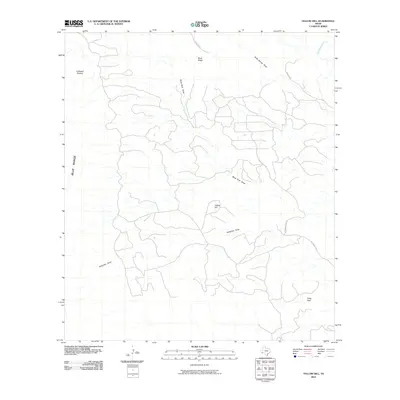
2010 Map of Yellow Hill
USGS Topo · Published 2010About this map
Lefthand Shutup and the Blue Range define the western reaches of this West Texas landscape, where dramatic topography is shaped by a complex network of ephemeral drainage systems. These arid watercourses, including Black Rock Draw and Saltgrass Draw, weave through a terrain punctuated by isolated summits such as Yellow Hill and Pinks Peak. The map details a sparse but deliberate network of transit, including Hen Egg Rd and Herman's Peak Rd, which navigate the elevation changes near Black Ridge. In the northeast corner, Terlingua Creek provides a significant hydrological marker. This 2010 survey reflects the remote character of Brewster County, documenting the specific named draws and peaks that serve as vital landmarks for navigation and land management in the high desert.
Find a feature on this map
14 named features on this map. Tap any name to fly to it.
Don’t see what you’re looking for? This feature index may not catch every label — zoom into the map to look around manually.
Map Details
Editions of this 2010 Yellow Hill Map
This is the sole edition of this map. No revisions or reprints were ever made.
Other maps of this area

1903 · Terlingua
USGS Topo · 1:125,000

1904 · Terlingua
USGS Topo · 1:125,000

1917 · Agua Fria
USGS Topo · 1:62,500

1917 · Tascotal Mesa
USGS Topo · 1:62,500

1931 · Lajitas
USGS Topo · 1:62,500

1937 · Agua Fria
USGS Topo · 1:62,500

1944 · Tascotal Mesa
USGS Topo · 1:62,500

1959 · Emory Peak
USGS Topo · 1:250,000

1965 · Emory Peak
USGS Topo · 1:250,000

1971 · Yellow Hill
USGS Topo · 1:24,000