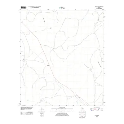
2010 Map of Altuda
USGS Topo · Published 2010About this map
Altuda sits at the heart of this Brewster County landscape, positioned along a major transportation corridor that cuts through the high desert terrain. The area is defined by its ranching history, with established homesteads like James Ranch and Youngs Ranch serving as primary landmarks across the open range. To the east, the rising slopes of Cathedral Mountain anchor the topography, while ephemeral drainage systems such as Emerson Draw and Stroud Draw carve the basin floor. Local water sources are sparse but critical, evidenced by Red Haw Spring and the winding course of Dugout Creek. The network of local roads, including Altuda Ranch Rd and Spicewood Ranch Rd, provides the essential connections between these remote ranching outposts and the railway line that parallels the highway through the center of the quadrangle.
Find a feature on this map
10 named features on this map. Tap any name to fly to it.
Don’t see what you’re looking for? This feature index may not catch every label — zoom into the map to look around manually.
Map Details
Editions of this 2010 Altuda Map
This is the sole edition of this map. No revisions or reprints were ever made.
Other maps of this area

1895 · Alpine
USGS Topo · 1:125,000

1920 · Monument Spring
USGS Topo · 1:62,500

1921 · Monument Spring
USGS Topo · 1:62,500

1923 · Altuda
USGS Topo · 1:62,500

1954 · Fort Stockton
USGS Topo · 1:250,000

1958 · Fort Stockton
USGS Topo · 1:250,000

1972 · Bird Mountain
USGS Topo · 1:24,000

1972 · Elam Mountain
USGS Topo · 1:24,000

1973 · Fort Stockton
USGS Topo · 1:250,000
1983 · Mount Ord
USGS Topo · 1:24,000