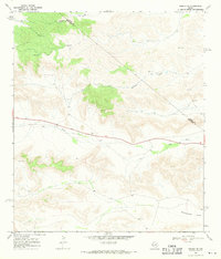
1968 Map of Tesnus NE
USGS Topo · Published 1971About this map
Pecos and Brewster County lines bisect this arid landscape, where the survival of cattle and wildlife depends on a sparse network of infrastructure. The terrain is defined by intermittent drainage systems, notably Downie Draw and Javelina Draw, which channel seasonal runoff through the hills. Human presence is marked primarily by ranching utilities such as numerous Water Tanks and a Gravel Pit near the central roadway. To the southeast, the topography softens into the level expanse of Rattlesnake Flats, a stark contrast to the dissected uplands that dominate the rest of the quadrangle. The map also records early telecommunications infrastructure with a Radio Tower situated on a high point, and the course of Dry Creek winding through the southern reaches, illustrating the critical role of water management in this high-desert environment during the late 1960s.
Find a feature on this map
9 named features on this map. Tap any name to fly to it.
Don’t see what you’re looking for? This feature index may not catch every label — zoom into the map to look around manually.
Map Details
Editions of this 1968 Tesnus NE Map
This is the sole edition of this map. No revisions or reprints were ever made.
Other maps of this area

1920 · Longfellow
USGS Topo · 1:125,000

1954 · Fort Stockton
USGS Topo · 1:250,000

1958 · Fort Stockton
USGS Topo · 1:250,000

1968 · Housetop Mountains
USGS Topo · 1:24,000

1968 · Tesnus
USGS Topo · 1:24,000

1968 · Cap Rock Butte
USGS Topo · 1:24,000

1968 · F C Ranch
USGS Topo · 1:24,000

1968 · Fresno Creek
USGS Topo · 1:24,000

1968 · Longfellow
USGS Topo · 1:24,000
1968 · Tesnus SE
USGS Topo · 1:24,000