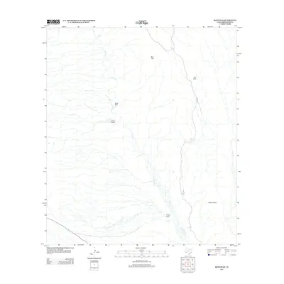
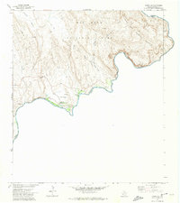
2012 Map of Roys Peak
USGS Topo · Published 2012About this map
Tornillo Cr carves a complex drainage network through this arid section of Brewster County, defining a landscape of deep canyons and prominent desert peaks. The drainage system reveals distinctive geologic features like the Banta Shut-In and the winding Estufa Canyon, where water has shaped the terrain over millennia. To the north, Roys Peak stands as a primary landmark overlooking the surrounding draws and relexes.
Find a feature on this map
10 named features on this map. Tap any name to fly to it.
Don’t see what you’re looking for? This feature index may not catch every label — zoom into the map to look around manually.
Map Details
Editions of this 2012 Roys Peak Map
This is the sole edition of this map. No revisions or reprints were ever made.
Other maps of this area

1903 · Chisos Mountains
USGS Topo · 1:125,000

1905 · Chisos Mountains
USGS Topo · 1:125,000

1930 · Stillwell Creek
USGS Topo · 1:62,500

1959 · Emory Peak
USGS Topo · 1:250,000

1965 · Emory Peak
USGS Topo · 1:250,000

1971 · Glenn Spring
USGS Topo · 1:24,000
1971 · McKinney Springs
USGS Topo · 1:24,000
1971 · Grapevine Hills
USGS Topo · 1:24,000
1971 · Ernst Valley
USGS Topo · 1:24,000
1971 · Boquillas
USGS Topo · 1:24,000