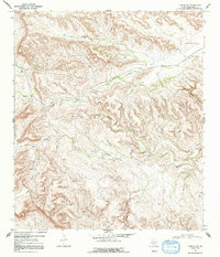
1968 Map of Tesnus SE
USGS Topo · Published 1992About this map
Southern Pacific railroad tracks bisect this high-desert landscape in Brewster County, marking a vital transit corridor through the Trans-Pecos region. The settlement at Rosenfeld and the nearby Cox Landing Field represent the sparse human footprint in a terrain dominated by complex drainage systems and deep cuts. Water management is the primary narrative of this 1968 survey, evidenced by numerous scattered labels for a Water Tank and a single Well across the arid flats. The map details the winding paths of Cox Creek, Maxon Creek, and Alamo Creek, which serve as the primary topographic markers. This era shows the early signs of resource extraction with the appearance of a Pumpjack near Oak Draw. To the south, the terrain becomes increasingly fractured, characterized by the deep incisions of McRae Canyon and Cortes Pet Canyon as the land falls toward the Rio Grande watershed.
Find a feature on this map
13 named features on this map. Tap any name to fly to it.
Don’t see what you’re looking for? This feature index may not catch every label — zoom into the map to look around manually.
Map Details
Editions of this 1968 Tesnus SE Map
2 editions found
Other maps of this area

1918 · Dove Mountain
USGS Topo · 1:62,500

1918 · Bullis Gap
USGS Topo · 1:62,500

1920 · Longfellow
USGS Topo · 1:125,000

1954 · Fort Stockton
USGS Topo · 1:250,000

1958 · Fort Stockton
USGS Topo · 1:250,000

1959 · Emory Peak
USGS Topo · 1:250,000

1965 · Emory Peak
USGS Topo · 1:250,000

1968 · Housetop Mountains
USGS Topo · 1:24,000

1968 · Tesnus
USGS Topo · 1:24,000

1968 · Fresno Creek
USGS Topo · 1:24,000