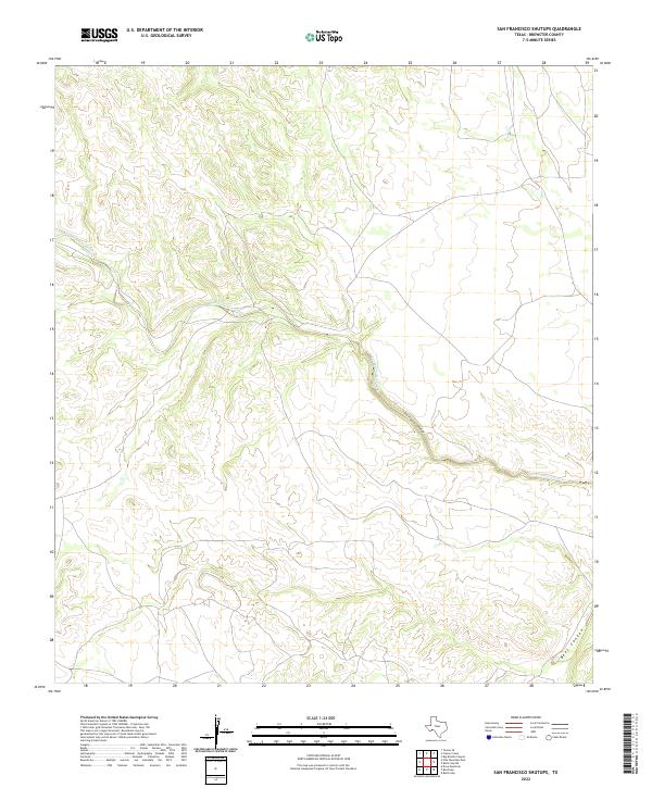
2022 Map of San Francisco Shutups
USGS Topo · Published 2022About this map
San Francisco Creek winds through this arid section of Brewster County, cutting through the high desert floor to form the distinctive narrow gorge known as the San Francisco Shutups. This topographical study illustrates the stark transition from open flats to steep-walled canyons, where the drainage pattern has carved deep incisions into the local strata. In the southeastern corner of the quadrangle, Beef Canyon joins the complex network of arroyos and washes that define the drainage of this Trans-Pecos landscape. The sparse network of primitive roads and 4WD tracks trace the contours of the terrain, providing access to this isolated topography as it was documented in 2022.
Find a feature on this map
3 named features on this map. Tap any name to fly to it.
Don’t see what you’re looking for? This feature index may not catch every label — zoom into the map to look around manually.
Map Details
Editions of this 2022 San Francisco Shutups Map
This is the sole edition of this map. No revisions or reprints were ever made.
Other maps of this area

1918 · Dove Mountain
USGS Topo · 1:62,500

1918 · Bullis Gap
USGS Topo · 1:62,500

1920 · Longfellow
USGS Topo · 1:125,000

1954 · Fort Stockton
USGS Topo · 1:250,000

1958 · Fort Stockton
USGS Topo · 1:250,000

1959 · Emory Peak
USGS Topo · 1:250,000

1965 · Emory Peak
USGS Topo · 1:250,000

1968 · Big Brindle Canyon
USGS Topo · 1:24,000

1968 · Fresno Creek
USGS Topo · 1:24,000
1968 · Tesnus SE
USGS Topo · 1:24,000