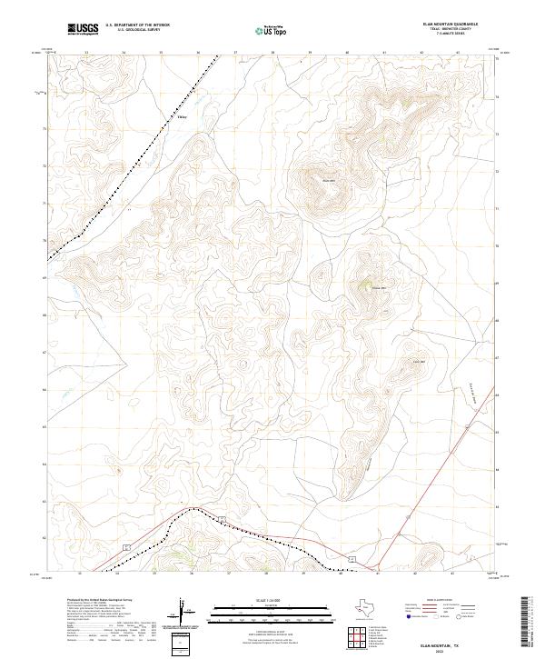
2022 Map of Elam Mountain
USGS Topo · Published 2022About this map
Titley sits at the northern edge of this high-desert landscape in Brewster County, where the topography is defined by significant volcanic and erosional peaks. Dominating the central and eastern portions of the map are the distinct elevations of Elam Mtn, House Mtn, and Cone Mtn. These formations rise sharply from the surrounding terrain, overlooking a network of seasonal drainage paths including Alpine Cr, Emerson Draw, and Ramsey Draw. The map illustrates a contemporary view of the region's sparse settlement and transit network, with major roadways cutting through the lower elevations to navigate the complex relief. This area is characteristic of the Trans-Pecos environment, where water flow is intermittent and land usage is dictated by the dramatic rises and falls of the mountain peaks.
Find a feature on this map
7 named features on this map. Tap any name to fly to it.
Don’t see what you’re looking for? This feature index may not catch every label — zoom into the map to look around manually.
Map Details
Editions of this 2022 Elam Mountain Map
This is the sole edition of this map. No revisions or reprints were ever made.
Other maps of this area

1894 · Fort Davis
USGS Topo · 1:125,000

1895 · Alpine
USGS Topo · 1:125,000

1897 · Fort Davis
USGS Topo · 1:125,000

1923 · Altuda
USGS Topo · 1:62,500

1929 · Hovey
USGS Topo · 1:125,000

1954 · Fort Stockton
USGS Topo · 1:250,000

1958 · Fort Stockton
USGS Topo · 1:250,000

1972 · Bird Mountain
USGS Topo · 1:24,000

1972 · Alpine North
USGS Topo · 1:24,000

1972 · Alpine South
USGS Topo · 1:24,000