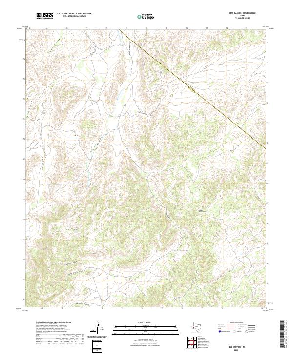
2022 Map of Hess Canyon
USGS Topo · Published 2022About this map
The Glass Mountains dominate this West Texas landscape, where deep drainage systems like Hess Canyon and Javelina Canyon carve through the high terrain. The land is defined by its dramatic relief and a network of ephemeral watercourses including Burnt House Cr, which winds through the central corridor. This 2022 survey captures a remote section of Brewster County, showing the intersection of natural landmarks and administrative boundaries at the Pecos and Brewster County line.
Find a feature on this map
16 named features on this map. Tap any name to fly to it.
Don’t see what you’re looking for? This feature index may not catch every label — zoom into the map to look around manually.
Map Details
Editions of this 2022 Hess Canyon Map
This is the sole edition of this map. No revisions or reprints were ever made.
Other maps of this area

1923 · Hess Canyon
USGS Topo · 1:62,500

1923 · Altuda
USGS Topo · 1:62,500

1929 · Hovey
USGS Topo · 1:125,000

1954 · Fort Stockton
USGS Topo · 1:250,000

1958 · Fort Stockton
USGS Topo · 1:250,000

1973 · Fort Stockton
USGS Topo · 1:250,000

1980 · Cave Mesa
USGS Topo · 1:24,000

1980 · Hovey
USGS Topo · 1:24,000
1980 · Cave Mesa SE
USGS Topo · 1:24,000
1983 · Gilliland Peak
USGS Topo · 1:24,000