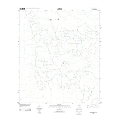
2012 Map of Yellow Hill
USGS Topo · Published 2012About this map
Yellow Hill stands as a central landmark in this remote corner of Brewster County, where the desert floor is defined by a network of seasonal drainages and dry washes. The topography is anchored by dramatic elevations including Pinks Peak and the curiously named Lefthand Shutup, a geologic formation near Black Ridge in the northern portion of the quadrangle. In this arid environment, the intermittent flow of Terlingua Cr serves as the primary hydrological feature, carving through the Chihuahuan Desert landscape. Human presence is marked by a sparse network of unpaved routes, such as Hen Egg Rd and Hermans Peak Rd, which provide the only access through this isolated terrain. The map captures a section of the Trans-Pecos region where water and topography dictated movement long before modern surveying.
Find a feature on this map
8 named features on this map. Tap any name to fly to it.
Don’t see what you’re looking for? This feature index may not catch every label — zoom into the map to look around manually.
Map Details
Editions of this 2012 Yellow Hill Map
This is the sole edition of this map. No revisions or reprints were ever made.
Other maps of this area

1903 · Terlingua
USGS Topo · 1:125,000

1904 · Terlingua
USGS Topo · 1:125,000

1917 · Agua Fria
USGS Topo · 1:62,500

1917 · Tascotal Mesa
USGS Topo · 1:62,500

1931 · Lajitas
USGS Topo · 1:62,500

1937 · Agua Fria
USGS Topo · 1:62,500

1944 · Tascotal Mesa
USGS Topo · 1:62,500

1959 · Emory Peak
USGS Topo · 1:250,000

1965 · Emory Peak
USGS Topo · 1:250,000

1971 · Yellow Hill
USGS Topo · 1:24,000