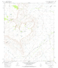
1980 Map of Last Chance Mesa
USGS Topo · Published 1981About this map
Last Chance Mesa dominates the landscape of this Brewster and Jeff Davis County border region, where high desert elevations meet a network of vital water management features. The area's ranching and transit history is defined by the Atchison Topeka and Santa Fe railroad, which cuts through the southeastern terrain near Musquiz Creek. The reliance on surface water in this arid environment is evident in the numerous named reservoirs and catchment points scattered across the topography, including Herradura Tank, Duck Tank, and Number Ten Tank. Navigating the complex drainage patterns, such as Hatch Canyon, is facilitated by a Jeep Trail that winds through the northern sections of the mesa. This 1980s-era documentation provides a precise view of the geographic intersections between the industrial rail lines and the practical infrastructure of West Texas land use.
Find a feature on this map
22 named features on this map. Tap any name to fly to it.
Don’t see what you’re looking for? This feature index may not catch every label — zoom into the map to look around manually.
Map Details
Editions of this 1980 Last Chance Mesa Map
This is the sole edition of this map. No revisions or reprints were ever made.
Other maps of this area

1894 · Fort Davis
USGS Topo · 1:125,000

1895 · Alpine
USGS Topo · 1:125,000

1897 · Fort Davis
USGS Topo · 1:125,000

1923 · Altuda
USGS Topo · 1:62,500

1929 · Hovey
USGS Topo · 1:125,000

1954 · Fort Stockton
USGS Topo · 1:250,000

1958 · Fort Stockton
USGS Topo · 1:250,000

1972 · Alpine North
USGS Topo · 1:24,000

1972 · Elam Mountain
USGS Topo · 1:24,000

1973 · Fort Stockton
USGS Topo · 1:250,000