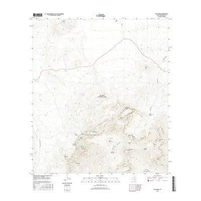
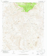
2016 Map of The Basin
USGS Topo · Published 2016About this map
Big Bend National Park serves as the backdrop for this topographic study centered on the high desert elevations of the Chisos Mountains. The map highlights the unique geomorphology of The Basin, a natural depression ringed by high peaks including Casa Grande Peak and Pulliam Peak. This area is a critical junction for modern travel and historical water access, where Basin Junction connects the rugged interior road network to the Ross Maxwell Scenic Dr. Natural springs like Kibbe Spring, Oak Spring, and Government Spring are identified, marking the sparse water sources that have dictated human activity in this arid environment. Elevation markers trace the dramatic drop at The Window and the steep contours of Cattail Canyon, while the high-altitude trails near Boot Canyon and Panther Pass provide a record of the park’s established transit routes.
Find a feature on this map
45 named features on this map. Tap any name to fly to it.
Don’t see what you’re looking for? This feature index may not catch every label — zoom into the map to look around manually.
Map Details
Editions of this 2016 The Basin Map
This is the sole edition of this map. No revisions or reprints were ever made.
Other maps of this area

1903 · Chisos Mountains
USGS Topo · 1:125,000

1905 · Chisos Mountains
USGS Topo · 1:125,000

1959 · Emory Peak
USGS Topo · 1:250,000

1965 · Emory Peak
USGS Topo · 1:250,000

1971 · Glenn Spring
USGS Topo · 1:24,000

1971 · Cerro Castellan
USGS Topo · 1:24,000
1971 · Grapevine Hills
USGS Topo · 1:24,000
1971 · Christmas Mountians
USGS Topo · 1:24,000
1971 · Tule Mountain
USGS Topo · 1:24,000
1971 · Emory Peak
USGS Topo · 1:24,000