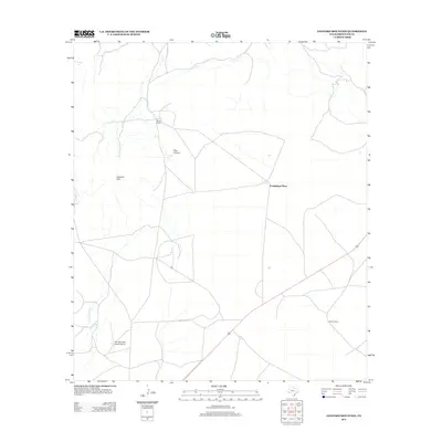
2012 Map of Leonard Mountain
USGS Topo · Published 2012About this map
Hess Ranch and Youngblood Place anchor this 2012 topographic study of the Brewster County landscape, where the vast rangelands of the Trans-Pecos are marked by isolated dwellings and aviation infrastructure. The presence of the Iron Mountain Ranch Airport near the southern boundary highlights the reliance on private air travel in this expansive terrain. Physical landmarks such as Leonard Mtn and the carved path of Hess Canyon dominate the topography, while Peña Colorado Cr winds through the southwestern sector. These features, along with Martin Ranch, illustrate a late-twentieth and early-twenty-first-century pattern of land use defined by large ranching estates and widely separated rural outposts connected by a sparse network of roads and natural drainages.
Find a feature on this map
7 named features on this map. Tap any name to fly to it.
Don’t see what you’re looking for? This feature index may not catch every label — zoom into the map to look around manually.
Map Details
Editions of this 2012 Leonard Mountain Map
This is the sole edition of this map. No revisions or reprints were ever made.
Other maps of this area

1920 · Monument Spring
USGS Topo · 1:62,500

1920 · Marathon
USGS Topo · 1:62,500

1921 · Monument Spring
USGS Topo · 1:62,500

1921 · Marathon
USGS Topo · 1:62,500

1923 · Hess Canyon
USGS Topo · 1:62,500

1923 · Altuda
USGS Topo · 1:62,500

1954 · Fort Stockton
USGS Topo · 1:250,000

1958 · Fort Stockton
USGS Topo · 1:250,000

1973 · Fort Stockton
USGS Topo · 1:250,000
1983 · Gilliland Peak
USGS Topo · 1:24,000