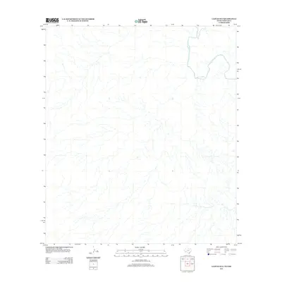
2012 Map of Lajitas OE S
USGS Topo · Published 2012About this map
The Rio Grande winds through this sparsely labeled borderland, forming the primary physical landmark in a terrain defined by complex drainage patterns and desert arroyos. This 2012 survey illustrates the winding course of the international boundary near Chihuahua, Mexico, capturing the hydrographic detail of the river before it enters the more confined canyons to the east. The absence of named human settlements or infrastructure emphasizes the remote, natural state of the river valley during the early 21st century. Researchers can use this sheet to study the specific geomorphology of the riparian corridor and the numerous unnamed tributary channels that descend toward the riverbank.
Find a feature on this map
1 named feature on this map. Tap any name to fly to it.
Don’t see what you’re looking for? This feature index may not catch every label — zoom into the map to look around manually.
Map Details
Editions of this 2012 Lajitas OE S Map
This is the sole edition of this map. No revisions or reprints were ever made.
Other maps of this area

1903 · Terlingua
USGS Topo · 1:125,000

1904 · Terlingua
USGS Topo · 1:125,000

1931 · Lajitas
USGS Topo · 1:62,500

1959 · Emory Peak
USGS Topo · 1:250,000

1965 · Emory Peak
USGS Topo · 1:250,000

1971 · Amarilla Mountain
USGS Topo · 1:24,000
1971 · Lajitas
USGS Topo · 1:24,000
1971 · Mesa De Anguila
USGS Topo · 1:24,000
1971 · Santana Mesa
USGS Topo · 1:24,000

1985 · Chisos Mountains
USGS Topo · 1:100,000