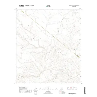
2019 Map of Candilla Canyon West
USGS Topo · Published 2019About this map
San Francisco Creek and its many seasonal tributaries define the complex drainage patterns at the intersection of Brewster and Terrell counties. This arid landscape is punctuated by water sources like Coe Springs, which have historically dictated movement and land use across these limestone canyons. The topography is dominated by significant landforms such as Five Mile Hill and deeply incised features like Candilla Canyon and Washboard Canyon. A network of unpaved tracks, including Five Mile Hill Rd and Rock Ravine Rd, provides access through the drainage basins of Cedar Cr and Maxon Creek. This map illustrates the intersection of natural water courses and primitive transportation routes in a region where local geography is dictated by the rugged winding of Brindle Canyon and Barrel Canyon.
Find a feature on this map
17 named features on this map. Tap any name to fly to it.
Don’t see what you’re looking for? This feature index may not catch every label — zoom into the map to look around manually.
Map Details
Editions of this 2019 Candilla Canyon West Map
This is the sole edition of this map. No revisions or reprints were ever made.
Other maps of this area

1918 · Bullis Gap
USGS Topo · 1:62,500

1918 · Indian Wells
USGS Topo · 1:62,500

1920 · Longfellow
USGS Topo · 1:125,000

1928 · Sanderson
USGS Topo · 1:125,000

1954 · Fort Stockton
USGS Topo · 1:250,000

1958 · Fort Stockton
USGS Topo · 1:250,000

1959 · Emory Peak
USGS Topo · 1:250,000

1965 · Emory Peak
USGS Topo · 1:250,000

1968 · Big Brindle Canyon
USGS Topo · 1:24,000

1969 · Sanderson SE
USGS Topo · 1:24,000