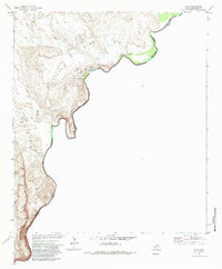
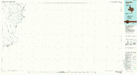
1970 Map of Solis
USGS Topo · Published 1984About this map
The Rio Grande carves a deep international boundary through this remote West Texas landscape, as documented in a 1970 field check. Located within the southern reaches of Big Bend National Park, the terrain is defined by the massive uplift of Mariscal Mountain and the winding corridor of San Vicente Canyon. Historically significant sites dot the riverbank, including the ruins at Casa de Piedra and small settlement points like Rooneys Place and Gomptons.
Find a feature on this map
21 named features on this map. Tap any name to fly to it.
Don’t see what you’re looking for? This feature index may not catch every label — zoom into the map to look around manually.
Map Details
Editions of this 1970 Solis Map
2 editions found
Other maps of this area

1903 · Chisos Mountains
USGS Topo · 1:125,000

1905 · Chisos Mountains
USGS Topo · 1:125,000

1959 · Emory Peak
USGS Topo · 1:250,000

1965 · Emory Peak
USGS Topo · 1:250,000
1970 · Solis
USGS Topo · 1:24,000

1971 · Glenn Spring
USGS Topo · 1:24,000
1971 · Boquillas
USGS Topo · 1:24,000
1971 · San Vicente
USGS Topo · 1:24,000
1984 · Boquillas
USGS Topo · 1:100,000

1985 · Chisos Mountains
USGS Topo · 1:100,000