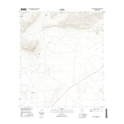
2016 Map of Leonard Mountain
USGS Topo · Published 2016About this map
Leonard Mountain dominates the western skyline of this Brewster County landscape, rising sharply above the desert floor and the drainage of Beakley Draw. This 2016 survey documents a sparsely populated ranching territory characterized by deep limestone cuts and seasonal watercourses. To the north and east, the terrain is defined by the high ridges surrounding Skinner Canyon and Hess Canyon, showing the complex relief of the Trans-Pecos. Evidence of modern land use and transportation is centered around the Iron Mountain Ranch Airport and the riparian corridor of Peña Colorado Cr, which provides a vital water source in this arid environment. The map illustrates how ranching operations have adapted to the severe topography, utilizing natural draws and basins for infrastructure and access.
Find a feature on this map
6 named features on this map. Tap any name to fly to it.
Don’t see what you’re looking for? This feature index may not catch every label — zoom into the map to look around manually.
Map Details
Editions of this 2016 Leonard Mountain Map
This is the sole edition of this map. No revisions or reprints were ever made.
Other maps of this area

1920 · Monument Spring
USGS Topo · 1:62,500

1920 · Marathon
USGS Topo · 1:62,500

1921 · Monument Spring
USGS Topo · 1:62,500

1921 · Marathon
USGS Topo · 1:62,500

1923 · Hess Canyon
USGS Topo · 1:62,500

1923 · Altuda
USGS Topo · 1:62,500

1954 · Fort Stockton
USGS Topo · 1:250,000

1958 · Fort Stockton
USGS Topo · 1:250,000

1973 · Fort Stockton
USGS Topo · 1:250,000
1983 · Gilliland Peak
USGS Topo · 1:24,000