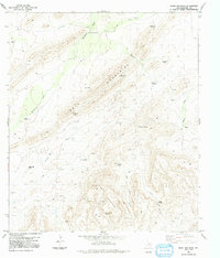
1983 Map of Heart Mountain
USGS Topo · Published 1991About this map
The Tinaja Mountains and Heart Mountain dominate this West Texas landscape, defining a region where water sources dictate human presence. Named springs and wells, such as Tinaja Spring, Wagon Well, Shovel Handle Spring, and Cane Spring, are the primary landmarks in an arid terrain carved by Hackberry Creek and Little Dark Canyon. The map reveals the infrastructure of remote ranching life through an extensive network of family-named and descriptive water-pumping sites, including Kriebaum Windmill, Yokey Windmill, and Burnt House Windmill. These features, connected primarily by 4wd tracks, illustrate the isolated nature of Brewster County's interior in the early 1980s. A solitary Landing Strip provides a necessary link to the outside world, underscoring the distance between these mountain outposts and established settlements.
Find a feature on this map
30 named features on this map. Tap any name to fly to it.
Don’t see what you’re looking for? This feature index may not catch every label — zoom into the map to look around manually.
Map Details
Editions of this 1983 Heart Mountain Map
2 editions found
Other maps of this area

1917 · Santiago Peak
USGS Topo · 1:62,500

1917 · Hood Spring
USGS Topo · 1:62,500

1918 · Bone Spring
USGS Topo · 1:125,000

1918 · Hood Spring
USGS Topo · 1:62,500

1918 · Santiago Peak
USGS Topo · 1:62,500

1920 · Monument Spring
USGS Topo · 1:62,500

1920 · Marathon
USGS Topo · 1:62,500

1921 · Monument Spring
USGS Topo · 1:62,500

1921 · Marathon
USGS Topo · 1:62,500

1931 · Hood Spring
USGS Topo · 1:62,500