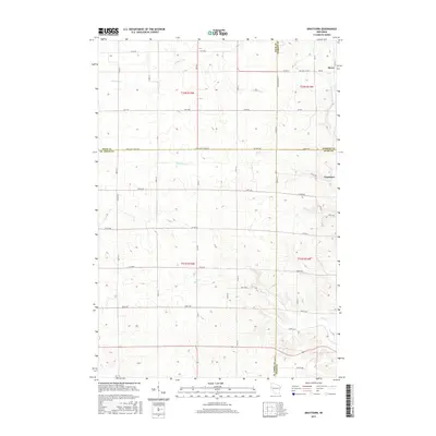
2015 Map of Graytown
USGS Topo · Published 2015About this map
Graytown and Reeve occupy a landscape defined by the convergence of four Wisconsin counties: Polk, Barron, St. Croix, and Dunn. This 2015 survey illustrates a rural geography where township lines and county borders dictate a precise grid of roads, such as Co Line Ave and Polk Saint Croix Rd. The terrain is drained by a network of waterways including the Willow River, Wolf Creek, and Bolen Creek, which cut through the agricultural sections. The map reveals the intricate secondary road system that connects isolated farmsteads to local hubs, shown through numbered routes like Co Hwy A and 230th Ave. This detailed view serves as a modern record of the dairy-land infrastructure and the persistent small-town settlements that have anchored this multi-county border region for generations.
Find a feature on this map
75 named features on this map. Tap any name to fly to it.
Don’t see what you’re looking for? This feature index may not catch every label — zoom into the map to look around manually.
Map Details
Editions of this 2015 Graytown Map
This is the sole edition of this map. No revisions or reprints were ever made.
Other maps of this area

1948 · Downing
USGS Topo · 1:62,500

1950 · Downing
USGS Topo · 1:62,500

1950 · Deer Park
USGS Topo · 1:62,500

1950 · Balsam Lake
USGS Topo · 1:62,500

1950 · Turtle Lake
USGS Topo · 1:62,500

1952 · Turtle Lake
USGS Topo · 1:62,500

1953 · Stillwater
USGS Topo · 1:250,000

1955 · Stillwater
USGS Topo · 1:250,000

1958 · Stillwater
USGS Topo · 1:250,000

1965 · Stillwater
USGS Topo · 1:250,000