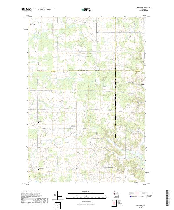
2022 Map of Graytown
USGS Topo · Published 2022About this map
The Willow River and its tributaries define the rural landscape at the meeting point of four Wisconsin counties: Barron, Dunn, Polk, and St. Croix. This agricultural and wetland region is dotted with early-established community hubs like Graytown and Reeve, alongside the edge of Clear Lake. Local genealogy is anchored by several notable burial grounds, including the Graytown Cem, Forest Cem, and those associated with local congregations such as Saint John Lutheran Cem and Immanuel Lutheran Cem. The terrain is shaped by a network of creeks, including Wolf Cr, Bolen Cr, and Jack Green Cr, which flow through the sections of T31N and T32N. The gridded road system, marked by identifiers like Co Hwy A and Co Line St, reflects the persistent rural organization of this upper Midwest borderland.
Find a feature on this map
59 named features on this map. Tap any name to fly to it.
Don’t see what you’re looking for? This feature index may not catch every label — zoom into the map to look around manually.
Map Details
Editions of this 2022 Graytown Map
This is the sole edition of this map. No revisions or reprints were ever made.
Other maps of this area

1948 · Downing
USGS Topo · 1:62,500

1950 · Downing
USGS Topo · 1:62,500

1950 · Deer Park
USGS Topo · 1:62,500

1950 · Balsam Lake
USGS Topo · 1:62,500

1950 · Turtle Lake
USGS Topo · 1:62,500

1952 · Turtle Lake
USGS Topo · 1:62,500

1953 · Stillwater
USGS Topo · 1:250,000

1955 · Stillwater
USGS Topo · 1:250,000

1958 · Stillwater
USGS Topo · 1:250,000

1965 · Stillwater
USGS Topo · 1:250,000