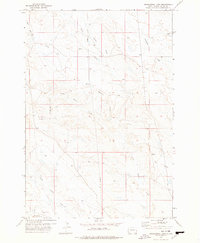
1977 Map of Greasewood Draw
USGS Topo · Published 1978About this map
North Indian Creek and its many seasonal tributaries carve through this section of Butte County, revealing a landscape defined by ranching and resource extraction. The map, based on fieldwork from the early 1970s, shows a sparse network of improved and unimproved roads connecting isolated water sources and industrial markers. Notable water features such as Bean Blossom Creek and Frog Creek dominate the drainage patterns, while the label Twin Dams indicates localized water management efforts essential for livestock in this arid environment. A prominent Pipeline corridor cuts north-south across the terrain, illustrating the modern infrastructure overlaid upon the traditional ranching lands. Geologists and local historians can trace the intricate network of draws, including Greasewood Draw and Watson Draw, which illustrate the topographical complexity of the northern plains before significant further development.
Find a feature on this map
11 named features on this map. Tap any name to fly to it.
Don’t see what you’re looking for? This feature index may not catch every label — zoom into the map to look around manually.
Map Details
Editions of this 1977 Greasewood Draw Map
This is the sole edition of this map. No revisions or reprints were ever made.
Other maps of this area

1901 · Aladdin
USGS Topo · 1:125,000

1903 · Aladdin
USGS Topo · 1:125,000

1905 · Indian
USGS Topo · 1:62,500

1907 · Belle Fourche
USGS Topo · 1:125,000

1935 · Harding
USGS Topo · 1:125,000

1953 · Rapid City
USGS Topo · 1:250,000

1954 · Lemmon
USGS Topo · 1:250,000

1954 · Ekalaka
USGS Topo · 1:250,000

1954 · Gillette
USGS Topo · 1:250,000

1955 · Gillette
USGS Topo · 1:250,000