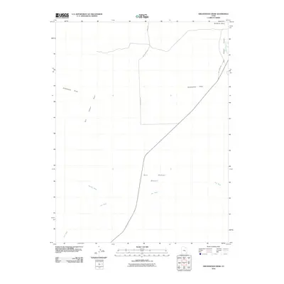
2010 Map of Greasewood Draw
USGS Topo · Published 2010About this map
The San Rafael River cuts through the northeast corner of this arid landscape, a vital watercourse in the otherwise parched San Rafael Desert. The terrain is defined by the dramatic uprising of the San Rafael Reef, which creates a natural barrier across the western portion of the quadrangle. Several ephemeral drainage systems, including Greasewood Draw, Straight Wash, and Iron Wash, underscore the erosional patterns of the Emery County backcountry. The northern boundary is marked by the elevated plateau of Shadscale Mesa, while the local road network is centered around the ranching infrastructure of the east, notably Hatts Ranch Rd and the Hatt's Ranch Byp. This survey captures the region's character as a crossroads of high-desert geological features and ranching access routes.
Find a feature on this map
9 named features on this map. Tap any name to fly to it.
Don’t see what you’re looking for? This feature index may not catch every label — zoom into the map to look around manually.
Map Details
Editions of this 2010 Greasewood Draw Map
This is the sole edition of this map. No revisions or reprints were ever made.
Other maps of this area

1885 · San Rafael
USGS Topo · 1:250,000

1953 · Tidwell 2 SW
USGS Topo · 1:24,000

1953 · Tidwell 3 NW
USGS Topo · 1:24,000

1953 · Tidwell 2 NW
USGS Topo · 1:24,000

1953 · Temple Mtn
USGS Topo · 1:62,500

1954 · Stinking Spring Creek 1 SE
USGS Topo · 1:24,000

1954 · Stinking Spring Creek 4 NE
USGS Topo · 1:24,000

1954 · Stinking Spring Creek 1 NE
USGS Topo · 1:24,000

1954 · Tidwell 2 SE
USGS Topo · 1:24,000

1954 · Tidwell 2 NE
USGS Topo · 1:24,000