
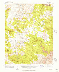
1953 Map of Tidwell 3 NW
USGS Topo · Published 1954About this map
San Rafael and the surrounding Desert landscape define this 1953 topographic study, which captures the stark hydrology of the Emery County region. The map reveals a reliance on isolated water sources such as Crows Nest Spring and Cottonwood Spring, which served as critical landmarks for travelers and ranchers in an otherwise arid environment. The deeply incised drainage of Cottonwood Wash snakes through the center of the sheet, illustrating the erosive forces that shaped the local topography. This preliminary edition, produced just after the mid-century using aerial photography, documents a period before significant modern development altered the drainage patterns. It provides a foundational record of the natural terrain, identifying small but vital features like a marked Seep that would be essential for anyone navigating the backcountry of the Utah desert during this era.
Find a feature on this map
6 named features on this map. Tap any name to fly to it.
Don’t see what you’re looking for? This feature index may not catch every label — zoom into the map to look around manually.
Map Details
Editions of this 1953 Tidwell 3 NW Map
This is the sole edition of this map. No revisions or reprints were ever made.
Other maps of this area

1885 · San Rafael
USGS Topo · 1:250,000

1953 · Tidwell 2 SW
USGS Topo · 1:24,000

1953 · Temple Mtn
USGS Topo · 1:62,500

1954 · Stinking Spring Creek 1 SE
USGS Topo · 1:24,000

1954 · Stinking Spring Creek 4 NE
USGS Topo · 1:24,000

1954 · Stinking Spring Creek 4 SE
USGS Topo · 1:24,000

1954 · Tidwell 2 SE
USGS Topo · 1:24,000

1954 · Tidwell Bottoms
USGS Topo · 1:62,500
1954 · The Wickiup
USGS Topo · 1:62,500

1956 · Salina
USGS Topo · 1:250,000