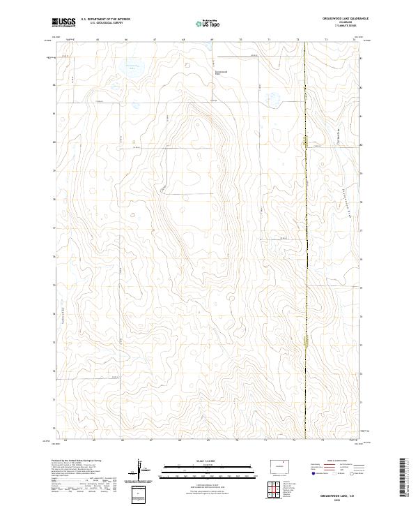
2022 Map of Greasewood Lake
USGS Topo · Published 2022About this map
Greasewood Lake and the surrounding high plains of northeastern Colorado define this landscape, where the ephemeral waters of the basin are hemmed in by the expansive Greasewood Flats. The area is characterized by a network of seasonal watercourses, including Greasewood Draw and Coal Bank Draw, which channel runoff through the arid terrain. This 2022 survey captures the modern grid of county roads, such as Co RD 70 and Co RD 89, that bisects the land into precise sections. The boundary between Weld Co and Morgan Co runs vertically through the eastern portion of the map, illustrating the administrative divisions in this sparsely settled region. The lack of concentrated structures or named towns underscores the agricultural and ranching character of the territory, where terrain features like Sanborn Draw serve as primary landmarks for navigation.
Find a feature on this map
23 named features on this map. Tap any name to fly to it.
Don’t see what you’re looking for? This feature index may not catch every label — zoom into the map to look around manually.
Map Details
Editions of this 2022 Greasewood Lake Map
This is the sole edition of this map. No revisions or reprints were ever made.
Other maps of this area

1950 · Greasewood Lake
USGS Topo · 1:24,000

1950 · Masters
USGS Topo · 1:24,000

1951 · Masters
USGS Topo · 1:24,000

1951 · Orchard
USGS Topo · 1:24,000

1951 · Sunken Lake
USGS Topo · 1:24,000

1951 · Point Of Rocks
USGS Topo · 1:24,000
1951 · Dearfield
USGS Topo · 1:24,000

1954 · Greeley
USGS Topo · 1:250,000

1957 · Greeley
USGS Topo · 1:250,000

1958 · Greeley
USGS Topo · 1:250,000