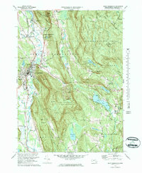
1973 Map of Great Barrington
USGS Topo · Published 1983About this map
Great Barrington and its surrounding hill country are captured here during the early 1970s, showing a landscape defined by the winding Housatonic River and the industrial corridors of the Penn Central railroad. The map records the cultural layer of the Berkshires, from the Golf Course and Fairgrounds in town to the Butternut Ski Area on the slopes of Warner Mtn. This era shows the expansion of local institutions, including the Monument Mountain High Sch and Dehon Seminary, alongside established community landmarks like St James Ch and Elmwood Cem. To the east, the extensive Beartown State Forest dominates the topography, containing significant water bodies like Lake Buel and Benedict Pond. The settlement pattern reflects the area's transition into a recreation and education hub, while keeping traces of older hamlets such as Van Deusenville and Risingdale.
Find a feature on this map
62 named features on this map. Tap any name to fly to it.
Don’t see what you’re looking for? This feature index may not catch every label — zoom into the map to look around manually.
Map Details
Editions of this 1973 Great Barrington Map
3 editions found
Other maps of this area

1885 · Sheffield
USGS Topo · 1:62,500

1886 · Becket
USGS Topo · 1:62,500

1888 · Sheffield
USGS Topo · 1:62,500

1888 · Becket
USGS Topo · 1:62,500

1888 · Sandisfield
USGS Topo · 1:62,500

1888 · Pittsfield
USGS Topo · 1:62,500

1890 · Pittsfield
USGS Topo · 1:62,500

1891 · Sheffield
USGS Topo · 1:62,500

1893 · Becket
USGS Topo · 1:62,500

1893 · Sheffield
USGS Topo · 1:62,500