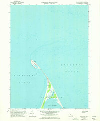
1972 Map of Great Point
USGS Topo · Published 1973About this map
Nantucket Island narrows into a slender, shifting arm of sand and salt marsh at its northernmost extremity in this 1972 survey. The landscape is defined by the fragile connection of The Galls, a thin strip of land separating the turbulent waters of the Atlantic Ocean from the sheltered reaches of Nantucket Sound. At the very tip stands the Lighthouse at Great Point, a critical maritime waypoint for vessels navigating the shoals of the Massachusetts coast.
Find a feature on this map
14 named features on this map. Tap any name to fly to it.
Don’t see what you’re looking for? This feature index may not catch every label — zoom into the map to look around manually.
Map Details
Editions of this 1972 Great Point Map
3 editions found

Other maps of this area

1889 · Nantucket
USGS Topo · 1:62,500

1893 · Nantucket
USGS Topo · 1:62,500

1901 · Nantucket
USGS Topo · 1:62,500

1942 · Nantucket
USGS Topo · 1:125,000

1945 · Nantucket
USGS Topo · 1:31,680

1945 · Siasconset
USGS Topo · 1:31,680

1945 · Great Point
USGS Topo · 1:31,680

1947 · Providence
USGS Topo · 1:250,000

1948 · Providence
USGS Topo · 1:250,000

1951 · Great Point
USGS Topo · 1:31,680