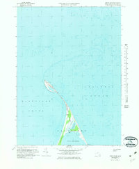
1972 Map of Great Point
USGS Topo · Published 1983About this map
Great Point and its iconic Lighthouse stand at the northern tip of this coastal survey, where the waters of the Atlantic Ocean meet Nantucket Sound. The narrow, sandy stretch of The Galls connects this remote point to the broader dunes of Coskata and the marshes of Coatue. This 1972 field-checked map illustrates the dynamic shoreline of northern Nantucket Island, featuring landforms like The Glades and the quiet waters of Coskata Pond. A single Jeep Trail provides the only overland access through the coastal scrub and tidal flats leading toward the small settlement of Wauwinet at the southern edge of the sheet. The map details the complex maritime environment of the Head of the Harbor, capturing a moment when these shifting sands were documented through mid-century aerial photography and precise planetable surveys.
Find a feature on this map
16 named features on this map. Tap any name to fly to it.
Don’t see what you’re looking for? This feature index may not catch every label — zoom into the map to look around manually.
Map Details
Editions of this 1972 Great Point Map
3 editions found

Other maps of this area

1889 · Nantucket
USGS Topo · 1:62,500

1893 · Nantucket
USGS Topo · 1:62,500

1901 · Nantucket
USGS Topo · 1:62,500

1942 · Nantucket
USGS Topo · 1:125,000

1945 · Nantucket
USGS Topo · 1:31,680

1945 · Siasconset
USGS Topo · 1:31,680

1945 · Great Point
USGS Topo · 1:31,680

1947 · Providence
USGS Topo · 1:250,000

1948 · Providence
USGS Topo · 1:250,000

1951 · Great Point
USGS Topo · 1:31,680