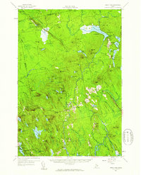
1957 Map of Great Pond
USGS Topo · Published 1959About this map
Aurora and Amherst serve as the primary hubs of this landscape, situated at a junction where the Union River winds through the interior of Hancock County. The map details a post-war era defined by both traditional rural settlement and modern military presence, notably the U S Air Force Survival Training Camp and the U S Air Force Recreation Area at Great Pond. Local education and community life are marked by numerous small schoolhouses, including the McKinley Sch, Pershing Sch, and Caruso Sch, while family-named landmarks like Jellison Hill and Silsby Hill indicate deep-rooted landholdings. To the north, an Abandoned Landing Strip and the Dow Pines area suggest changing land uses, even as the network of brooks like Alligator Stream and The Whalesback Branch maintain the traditional drainage patterns of the region.
Find a feature on this map
135 named features on this map. Tap any name to fly to it.
Don’t see what you’re looking for? This feature index may not catch every label — zoom into the map to look around manually.
Map Details
Editions of this 1957 Great Pond Map
4 editions found
Other maps of this area

1900 · Orland
USGS Topo · 1:62,500

1902 · Orono
USGS Topo · 1:62,500

1911 · Ellsworth
USGS Topo · 1:62,500

1917 · Passadumkeag
USGS Topo · 1:62,500

1929 · Great Pond
USGS Topo · 1:48,000

1929 · Lead Mountain
USGS Topo · 1:48,000

1930 · Tunk Lake
USGS Topo · 1:48,000

1931 · Saponac
USGS Topo · 1:48,000

1932 · Tunk Lake
USGS Topo · 1:62,500

1932 · Nicatous Lake
USGS Topo · 1:48,000