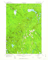
1957 Map of Great Pond
USGS Topo · Published 1963About this map
Amherst and Aurora serve as the primary hubs in this mid-century survey of the Maine woods, where the landscape is defined by the Union River and its complex network of tributaries. The map documents a period of Cold War military utility in the wilderness, featuring the U S Air Force Survival Training Camp near Pickeral Pond and a Landing Strip (Abandoned) in Greenfield. Local infrastructure is well-recorded, from the Ledge Falls Dam and Twin Bridges to numerous rural schoolhouses like McKinley Sch and Washington Sch. The eastern section is marked by a unique road feature known as The Whaleback, which winds through the forests of Plantation No 33. Families and genealogists can find several established burial grounds, including the Hadley Cem, Spaulding Cem, and Jackson Cem, providing a clear record of 20th-century settlement patterns in Hancock County.
Find a feature on this map
143 named features on this map. Tap any name to fly to it.
Don’t see what you’re looking for? This feature index may not catch every label — zoom into the map to look around manually.
Map Details
Editions of this 1957 Great Pond Map
4 editions found
Other maps of this area

1900 · Orland
USGS Topo · 1:62,500

1902 · Orono
USGS Topo · 1:62,500

1911 · Ellsworth
USGS Topo · 1:62,500

1917 · Passadumkeag
USGS Topo · 1:62,500

1929 · Great Pond
USGS Topo · 1:48,000

1929 · Lead Mountain
USGS Topo · 1:48,000

1930 · Tunk Lake
USGS Topo · 1:48,000

1931 · Saponac
USGS Topo · 1:48,000

1932 · Tunk Lake
USGS Topo · 1:62,500

1932 · Nicatous Lake
USGS Topo · 1:48,000