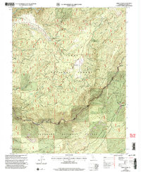
2000 Map of Greek Store
USGS Topo · Published 2003About this map
Gold mining history and deep canyons define this portion of the Sierra Nevada near the border of Tahoe National Forest and Eldorado National Forest. The landscape is heavily marked by late 19th and early 20th-century extraction, with numerous named claims such as the Star Town Mine, Millers Defeat Mine, and the Last Chance Mine scattered across the ridgelines. The transition from active mining to conservation is evident in the presence of the Placer Co Grove and the protected Sierra Redwoods accessible via the Big Tree Nature Trail.
Find a feature on this map
91 named features on this map. Tap any name to fly to it.
Don’t see what you’re looking for? This feature index may not catch every label — zoom into the map to look around manually.
Map Details
Editions of this 2000 Greek Store Map
This is the sole edition of this map. No revisions or reprints were ever made.
Other maps of this area

1889 · Pyramid Peak
USGS Topo · 1:125,000

1891 · Colfax
USGS Topo · 1:125,000

1891 · Truckee
USGS Topo · 1:125,000

1891 · Placerville
USGS Topo · 1:125,000

1891 · Pyramid Peak
USGS Topo · 1:125,000

1892 · Placerville
USGS Topo · 1:125,000

1892 · Colfax
USGS Topo · 1:125,000

1893 · Placerville
USGS Topo · 1:125,000

1893 · Truckee
USGS Topo · 1:125,000

1894 · Colfax
USGS Topo · 1:125,000