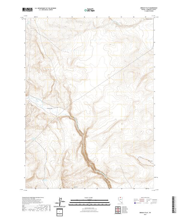
2021 Map of Greeley Flat
USGS Topo · Published 2021About this map
The N Fork Little Humboldt River carves a winding path through this high-desert landscape in northern Humboldt County. This 2021 topographic survey reveals a terrain defined by subtle drainage patterns and seasonal water storage, centered on the broad expanse of Greeley Flat. The presence of Big Sage Reservoir and Sagehen Reservoir suggests a pastoral reliance on water management in an otherwise arid environment. Along the northern margins, the Little Owyhee River enters the Owyhee Desert, marking the transition between major drainage basins. For researchers, the map provides a clear view of the modern rangeland infrastructure, including isolated water sources like Antelope Spring and the distinctive contours of the Red Hills to the south. Small, localized features such as Evans Lake illustrate the specific hydrology of this sparsely populated corner of Nevada.
Find a feature on this map
15 named features on this map. Tap any name to fly to it.
Don’t see what you’re looking for? This feature index may not catch every label — zoom into the map to look around manually.
Map Details
Editions of this 2021 Greeley Flat Map
This is the sole edition of this map. No revisions or reprints were ever made.
Other maps of this area

1882 · Paradise
USGS Topo · 1:250,000

1893 · Paradise
USGS Topo · 1:250,000

1955 · McDermitt
USGS Topo · 1:250,000

1959 · McDermitt
USGS Topo · 1:250,000

1980 · Capitol Peak
USGS Topo · 1:24,000
1980 · Button Lake
USGS Topo · 1:24,000

1980 · Greeley Flat
USGS Topo · 1:24,000

1980 · Hardscrabble
USGS Topo · 1:24,000
1980 · Maiden Butte
USGS Topo · 1:24,000
1980 · Greeley Flat SE
USGS Topo · 1:24,000