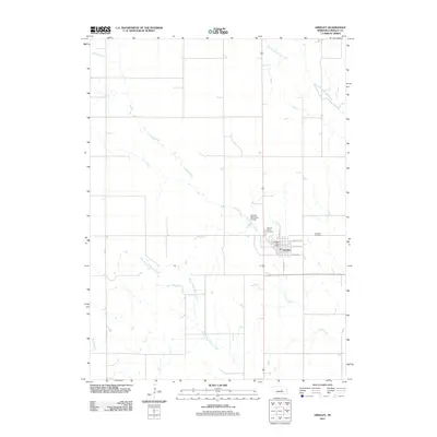
2011 Map of Greeley
USGS Topo · Published 2011About this map
The town of Greeley sits at the heart of this agricultural landscape, where the street names of E Wicklow Ave, Galway St, and S Kildare St reflect the heritage of this Nebraska community. The settlement is centered around the Greeley Post Office, while the surrounding prairie is defined by the wandering paths of Spring Creek and its tributaries, including the East Branch Spring Creek and West Branch Spring Creek. Local history and genealogy are anchored by two distinct burial grounds: Sacred Heart Cemetery just north of town and the Swedish Cemetery to the east. The presence of the Greeley Municipal Airport near the creek indicates the modernization of transportation in this rural county seat, even as the land remains dominated by the drainage systems of the Fish Creek basin.
Find a feature on this map
14 named features on this map. Tap any name to fly to it.
Don’t see what you’re looking for? This feature index may not catch every label — zoom into the map to look around manually.
Map Details
Editions of this 2011 Greeley Map
This is the sole edition of this map. No revisions or reprints were ever made.
Other maps of this area

1899 · Loup
USGS Topo · 1:125,000

1899 · St. Paul
USGS Topo · 1:125,000

1953 · Scotia NE
USGS Topo · 1:24,000

1953 · Scotia
USGS Topo · 1:24,000

1954 · Horace
USGS Topo · 1:24,000

1954 · Greeley NE
USGS Topo · 1:24,000

1954 · Greeley
USGS Topo · 1:24,000

1954 · Greeley NW
USGS Topo · 1:24,000

1954 · Spalding SW
USGS Topo · 1:24,000

1954 · Wolbach
USGS Topo · 1:24,000