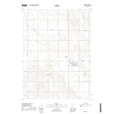
2017 Map of Greeley
USGS Topo · Published 2017About this map
Greeley Center serves as the focal point of this Greeley County landscape, situated where the high plains meet the intricate drainage systems of Spring Creek. The town's grid is detailed with street names like W O'Neill Ave and E Emmet Ave, while the surrounding terrain is defined by the broad Boston Valley to the southwest. This area reflects a long-standing agricultural and community structure, evidenced by established landmarks such as the Sacred Heart Cemetery and Swedish Cemetery.
Find a feature on this map
28 named features on this map. Tap any name to fly to it.
Don’t see what you’re looking for? This feature index may not catch every label — zoom into the map to look around manually.
Map Details
Editions of this 2017 Greeley Map
This is the sole edition of this map. No revisions or reprints were ever made.
Other maps of this area

1899 · Loup
USGS Topo · 1:125,000

1899 · St. Paul
USGS Topo · 1:125,000

1953 · Scotia NE
USGS Topo · 1:24,000

1953 · Scotia
USGS Topo · 1:24,000

1954 · Horace
USGS Topo · 1:24,000

1954 · Greeley NE
USGS Topo · 1:24,000

1954 · Greeley
USGS Topo · 1:24,000

1954 · Greeley NW
USGS Topo · 1:24,000

1954 · Spalding SW
USGS Topo · 1:24,000

1954 · Wolbach
USGS Topo · 1:24,000